Travelling to the Alps by Train
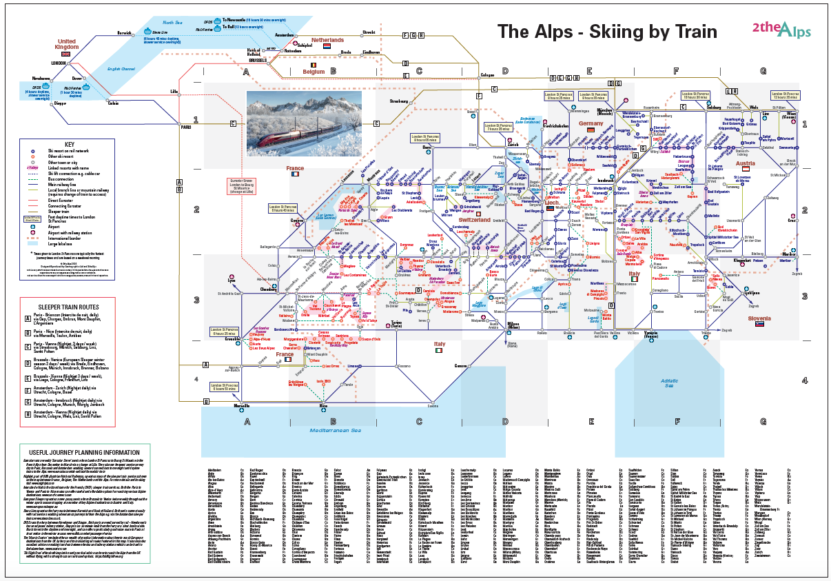
- Shows routes from the UK (by train and ferry) to seven Alpine countries - Austria, France, Germany, Italy, Liechtenstein, Slovenia, Switzerland
- Shows sleeper train routes and has useful planning information
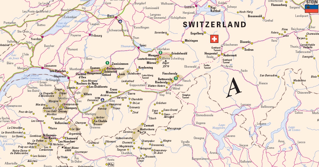
- Rail-served resorts highlighted including well known destinations such as Zermatt, St Anton, Chamonix and Kitzbuhel
- Over 20 linked ski areas including The 3 Valleys, Portes du Soleil and Sella Ronda
- Resorts not on the rail network such as Meribel, Saas Fee and Courmayeur shown with bus links to the nearest station
- Also includes lesser-known gems such as Greolieres Les Neiges in Provence, with views across the Mediterranean to Corsica, and Switzerland's Stoos, home of the world's steepest funicular train
- Includes journey times by train from UK to several Alpine cities
- Available as printed copy with a choice of media (matt or gloss paper or laminated). Other options (including downloads) available via our partner Cosmographics
- Complements our Ski Resort Map of the Alps
A2 Matt Paper Print
A2 Laminated Paper Prints
A2 Satin Photo Paper Print
For More options please see the options at our partner Cosmographics
Also available as a customised map
Published: December 2025
Format: Matt Paper Print
ISBN: 978 1 85879 7434
Sheet size: 592 x 420 mm
£17.00 (includes UK shipping)
Format: Laminated Matt or Satin Paper Print
ISBN: 978 1 85879 7441
Sheet size: 592 x 420 mm
£22.50 (includes UK shipping)
Format: Satin Photo Paper Print
Sheet size: 592 x 420 mm
£18.00 (includes UK shipping)
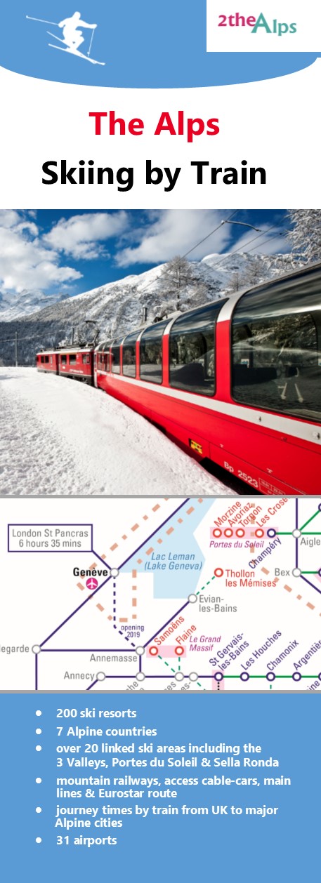
The Alps - Skiing by Train 2019
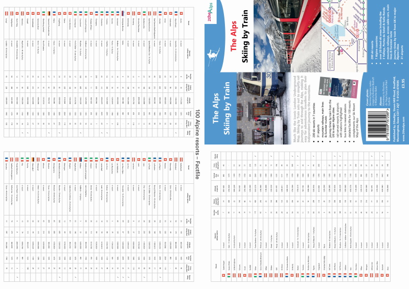
- Covers seven Alpine countries - Austria, France, Germany, Italy, Liechtenstein, Slovenia, Switzerland
- Reverse (folded map only) includes factfile for 100 resorts detailing nearest railway station, number of ski lifts, extent of downhill skiing (km), altitude range (m), vertical drop (m) and availability of glacier skiing and cross country skiing. NOTE: Reverse NOT printed on single sided print versions or high resolution prints
Skiing by Train - Folded Map (420 x 297mm)
Published: October 2019
Format: Folded map (double sided)
ISBN: 978 1 85879 7298
Sheet size: 420 x 297 mm
Folded size: 210 x 74.25 mm
£4.65 (includes UK shipping)
Format: High resolution A3 download (single sided) in English, German or Polish.
Available via our partner Cosmographics
From £3.95
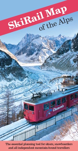
SkiRail Map of the Alps
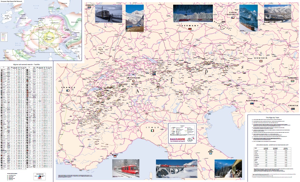
- the entire Alpine region at an approximate scale of 1: 1,400,000
- clear mapping showing the rail network through the Alps and the location of over 400 ski resorts
- detailed information on over 100 ski resorts directly accessible by train including extent of downhill and cross-country skiing, altitude range and vertical drop, number of lifts, difficulty of skiing, rail journey times to the nearest major city
- rail routes to the Alps from over ten European countries with approximate journey times
- free booklet containing detailed resort and country information plus contributions from Rail Europe and the Ski Club of Great Britain
BUY MAP
Published: 2011
Scale: 1: 1,400,000
Folded map with insert booklet
ISBN: 978 1 85879 6918
Sheet size: 1180 x 720 mm
£4.50 (includes UK shipping)
Paper wall map
ISBN: 978 1 85879 6925
Sheet size: 1180 x 720 mm
£16.00 (includes UK shipping)
Encapsulated wall map
ISBN: 978 1 85879 6932
Sheet size: 1180 x 720 mm
£27.00 (includes UK shipping)